Northgate
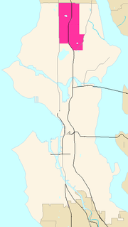
 Northgate is an informal district of neighborhoods in north urban Seattle, Washington, named for and surrounding Northgate Mall, the first covered mall in the United States. Its east-west principal arterials are NE Northgate Way and 130th Street, and its north-south principal arterials are Roosevelt Way NE and Aurora Avenue N (SR 99). Minor arterials are College Way-Meridian Avenue N, 1st, 5th, and 15th avenues NE. Interstate 5 runs through the district. Besides the eponymous mall, the most characteristic distinctions of the area are North Seattle Community College (NSCC), the south fork of the Thornton Creek watershed, and the mosque.
Northgate neighborhoods are:
- Haller Lake
- Pinehurst
- Licton Springs–North College Park
- Maple Leaf
As well as the informal district of neighborhoods, Northgate is also Northgate Mall, the shopping center within the Maple Leaf neighborhood of Northgate.
North College Park became defined with the Licton Springs neighborhood with the establishment of North Seattle Community College (NSCC), opened 1970. Licton Springs takes its name from Liq'tid (LEEK-teed) or Licton, the Lushootseed (Whulshootseed) Coast Salish word for the reddish mud of the springs—one of the few Puget Sound Salish words still used as a place name.
As headwaters of the south fork of the Thornton Creek watershed, Sunny Walter-Pillings Pond and NSCC wetland in Licton Springs–North College Park are headwaters of Thornton Creek under the Northgate Mall development. These neighborhoods are natural extensions of Maple Leaf downstream. Neighborhood activists and NSCC have been promoting habitat restoration in support.
The Sheihk Idriss Mosque in Pinehurst has architecture unique in Seattle. An octagonal dome and a symbolic minaret, both sheathed in copper and capped with crescent moons, red brick walls banded with buff brick and tall glass-block windows topped with concrete lintels in the shape of Moorish arches distinguish the first mosque in Seattle (1981) and the first mosque west of the Mississippi River to be built in a Middle Eastern design.
What is now Northgate has been inhabited since the end of the last glacial period (c. 8,000 B.C.E.—10,000 years ago). The Dkhw’Duw’Absh, People of the Inside and Xacuabš, People of the Large Lake, Lushootseed (Skagit-Nisqually) Coast Salish native people had used the Liq'tid Springs area as a spiritual health spa. They harvested cranberries from the Slo’q `qed (SLOQ-qed, bald head), an 85 acre (34 ha) marsh and bog at what is now the NSCC car park, Interstate 5 interchange, and Northgate Mall. Large open areas for game habitat and foraging (anthropogenic grasslands) were maintained in what are now these neighborhoods by selective burning every few years. Today the Native American descendents are represented by the Duwamish Tribe.
Haller Lake
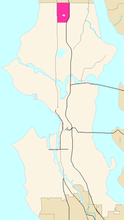
 Haller Lake is a small lake and neighborhood in north central Seattle, Washington, named for Theodore N. Haller, who platted the neighborhood in 1905. His father, Granville O. Haller, was one of Seattle's early settlers, an army officer who amassed a large estate in the region. Originally called Welsh or Welch Lake, the lake is located between N. 128th Street to the north, N. 122nd Street to the south, Densmore Avenue N. to the west, and Corliss Avenue N. to the east.
The lake covers 15 acres (61,000 m²); its volume is 247 acre-feet (305,000 m³) and its maximum depth is 36 ft (11 m). Its shoreline is private except for two public access points, the Meridian Avenue N. right-of-way on the north shore and the N. 125th Street right-of-way on the west.
The boundaries of the neighborhood are N. 145th Street to the north, beyond which is the city of Shoreline; N. 110th Street to the south, beyond which is Northgate; Aurora Avenue N. to the west, beyond which is Bitter Lake; and Interstate 5 to the east, beyond which is Lake City.
Within the neighborhood are Northacres Park, a large, forested public park just east of the lake on 1st Avenue N.E.; Ingraham High School, just north of the lake on N. 130th Street; Lakeside School, alma mater of Bill Gates and Paul Allen, in the northeast corner of the neighborhood just west of I-5; and Northwest Hospital and Medical Center, which occupies a 33 acre (13 hectare) campus southwest of the lake on N. 115th Street.
The Haller Lake Community Club at 12579 Densmore Avenue N. was formed in 1922 as the Haller Lake Improvement Club. It features a Wurlitzer theatre pipe organ installed in 1969.
In September 2005, the Seattle City Council unanimously approved projects to be funded through the second cycle of the Pro Parks Levy Opportunity Fund, including $150,000 for the Haller Lake Community Street End project. This project will start in 2006.
Licton Springs
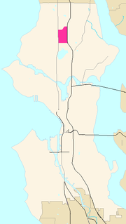
 Licton Springs or North College Park is a neighborhood in the Northgate informal district of North Seattle. It is bounded by Interstate 5 to the east, beyond which is Maple Leaf neighborhood and the Northgate Mall; Aurora Avenue N (SR 99) to the west, beyond which is Greenwood; N 85th Street to the south, beyond which is Green Lake, and N 105th Street and N Northgate Way to the north, beyond which is Haller Lake.
Licton Springs celebrates its long history as both a unique recreational spot and a commercial crossroads. The residential neighborhood wedged between the busy corridors of Interstate 5 and Aurora Avenue takes its name from Liq'tid (LEEK-teed) or Licton, the Lushootseed (Whulshootseed) Coast Salish word for the reddish mud of the springs—one of the few Puget Sound Salish words still used as a place name. The Dkhw’Duw’Absh, People of the Inside and Xacuabš, People of the Large Lake, Lushootseed (Skagit-Nisqually) Coast Salish native people had used the springs area as a spiritual health spa since the area was populated after the last glacial period (c. 8,000 B.C.E.—10,000 years ago). In the 1850s, the Dkhw’Duw’Absh and Xacuabš became the Duwamish tribe of today.
European settlement
Seattle pioneer David Denny built a summer cabin (c. 1870). The natural spring fed Green Lake before it was capped and drained to the Metro sewer system after it became contaminated by residential development (1920, 1931). The Olmsted Brothers designed a park for Licton Springs, as part of a grand streets and parks plan for Seattle (1930s), but this park was never implemented. All that remains is where Woodlawn Avenue curves to connect with N 95th Street. The spring is today located in Licton Springs Park. In the mid-1960s restoration began with bond issues and increasing volunteer assistance, resulting in a small pond and natural wetland vegetation as well as urban park amenities. A building located SSW from the springs has beautiful murals.
The Everett and Interurban Railway Company (1900-1936) came past the neighborhood in 1906. The trolleys became a part of everyday life and development of residential neighborhoods around trolley stops. Running on a narrow right-of-way through backyards, the whistle became part of the atmosphere of neighborhoods like Licton Springs. In the early years, the line ran through cut forest and rural farms. A few sawmills along the way gave the line a business hauling lumber. The rough wagon road became Aurora Avenue N (1930) after being paved with brick (1913) and asphalt (1928). A most distinctive early feature was the motorist "tourist camps", "auto camps", and later, "auto courts", then the now-familiar motels. One or two still remained at the turn of the 20th century.
The Pilling family had a dairy farm (1909-1933), out of which grew the waterfowl habitat and birding site of Plllings Pond today. Japanese-Americans had greenhouses and small farms until they were abruptly forcibly removed with the Japanese American Internment (1942-1945).
North College Park
Seattle annexed most of North Seattle in 1954. North College Park became defined with the Licton Springs neighborhood with the establishment of North Seattle Community College (1970).
As headwaters of the south fork of the Thornton Creek watershed, Sunny Walter–Pillings Pond and North College Park wetland are headwaters of Thornton Creek under the Northgate Mall development. These neighborhoods are natural extensions of Maple Leaf downstream. Neighborhood activists and North Seattle Community College (NSCC) have been promoting habitat restoration in support. NSCC grounds have a nationally-recognized native habitat, a pentimento of restored native species on a palimpsest of former 1940s suburb, former dairy farm, former bog where native Dkhw’Duw’Absh harvested cranberries.
Maple Leaf
 Maple Leaf is a mostly residential neighborhood in Seattle, originally a rural suburb (subdivided c. 1894) named Maple Leaf Addition to the Green Lake Tract or Green Lake Circle. The name may have come from the Maple Saw Mill that operated to the east on Lake Washington or from maple trees that once grew in the area.
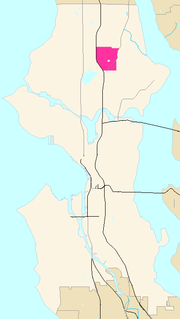
The plat is located between what would later be named NE 85th and 105th Streets and 5th and 25th Avenues NE. It was annexed to Seattle in the early 1950s. It is bounded by Lake City Way NE (SR 522) to the south, beyond which is the Roosevelt neighborhood; to the north by NE 100th, 105th, or 110th Streets (the latter was renamed Northgate Way in 1950), beyond which is the Pinehurst neighborhood of the Northgate district, by NE 95th Street west of 15th Avenue NE; to the east by 15th and 20th Avenues NE, beyond which are the Lake City neighborhoods; and Interstate 5 to the west, beyond which is North College Park or Licton Springs, map. (Seattle neighborhoods boundaries are informal).
Maple Leaf is home to approximately 20,000 residents, mostly residing in "classic Seattle boxes", (so initially a pejorative, wryly belied today by their high quality and prices), known locally as Seattle bungalows and Tudoresque style houses. Since 2000 the Maple Leaf area has been undergoing considerable renovation as smaller, older homes sitting on 1/8 acre lots are being bulldozed to make room for new high-end Craftsman style homes.
Besides Northgate Mall (1950), most of the businesses within Maple Leaf line Roosevelt Way NE from NE 75th to 100th Streets and 5th Avenue NE from NE 85th to 90th Streets. Notable neighborhood meeting spots on Roosevelt include Cloud City Coffee at 88th, family-owned Stephenson Ace Hardware at 91st, Judy Fu's Snappy Dragon at 90th, Joe's Restaurant & Bar at 89th, the Reservoir Bar at 85th, and the Maple Leaf Grill at 92nd. Cabinetworks is long-established and one of the few woodworking manufacturers remaining in Seattle.
A distinctive feature of the neighborhood is the water tower and reservoir located at 85th and Roosevelt. The water tower is painted with a distinctive coupling of maple leaves. Across Roosevelt Way from the water tower and reservoir is Saint Catherine's School and Church. Just south is The Fairview Church and The Fairview School, one of the largest private primary schools in the city. The north county offices of Camp Fire Boys and Girls are in the old Waldo Hospital, itself a distinctive architecture and green space.
Maple Leaf is one of two homes for a flock of feral conures (parrots) descended from escaped pets. They fly between Maple Leaf and Seward Park.
The highest point in Maple Leaf, located on 91st Street between Roosevelt Way and 5th Avenue, is over 500 feet (150 meters) in elevation, one of the highest points in the city. (High Point in West Seattle is 20 feet higher.)